GIS services
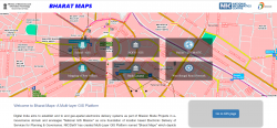
Bharat Maps, A Multi-layer GIS Platform
Information Technology, as a cross-cutting frontier of knowledge, has opened several new vistas of applications for daily needs of the civil society. One of them is Geographical Information System GIS technology, which is rapidly becoming a catalyst for several transformational changes in the...
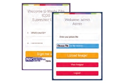
Malnutrition Monitoring System - Fostering the Implementation of ICDS in Malda, West Bengal
The system helps to sort the data based on different key parameters like child growth, MUAC (Mean Upper Arm Circumference) and breastfeeding status, and therefore to identify areas of concern and implement directed intervention. This system has recently upgraded to incorporate detailed information regarding...
Use of Hybrid Survey Methodology and Bhu-Sarvekshan Software for Resurvey in Bihar
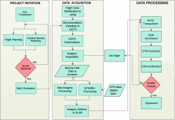
The Bihar state - spread over approx. 94163 sq. Km area, has an administrative setup comprising of 9 divisions, 38 districts, 101 subdivisions, 534 circles and 45,700 mauza(s) i.e. revenue villages. The very first survey of land i.e. Cadastral Survey (CS) of the state was conducted almost a century ago....
Waqf Management System of India (WAMSI)
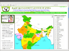
Waqf is the permanent dedication by a person professing Islam, of movable or immovable properties for any purpose recognized by the Islamic law as pious, religious or charitable. Waqf Management System of India (WAMSI) is an integrated on-line work flow based Information System for the management...
ICT ENABLED IMPLEMENTATION OF FOREST RIGHTS ACT 2006 IN MAHARASHTRA
Today, Information and Communication Technology has infiltrated the remotest corners of the Earth. The Government of Maharashtra came up with an ICT based innovation to preserve the forests and the rights of those who live in these remote forest areas. Implementation of GIS and other ICT...


 Subscribe

 Flipbook
 PDF (5.0 MB)
